A Unique Point Of View - Using Drones for Fun and Profit


We’ve all seen them on television: Gorgeous aerial photos of a field being harvested, just the kind of thing that farmers respond to. Expensive helicopters used to be hired for that footage, but today it is done with drones.
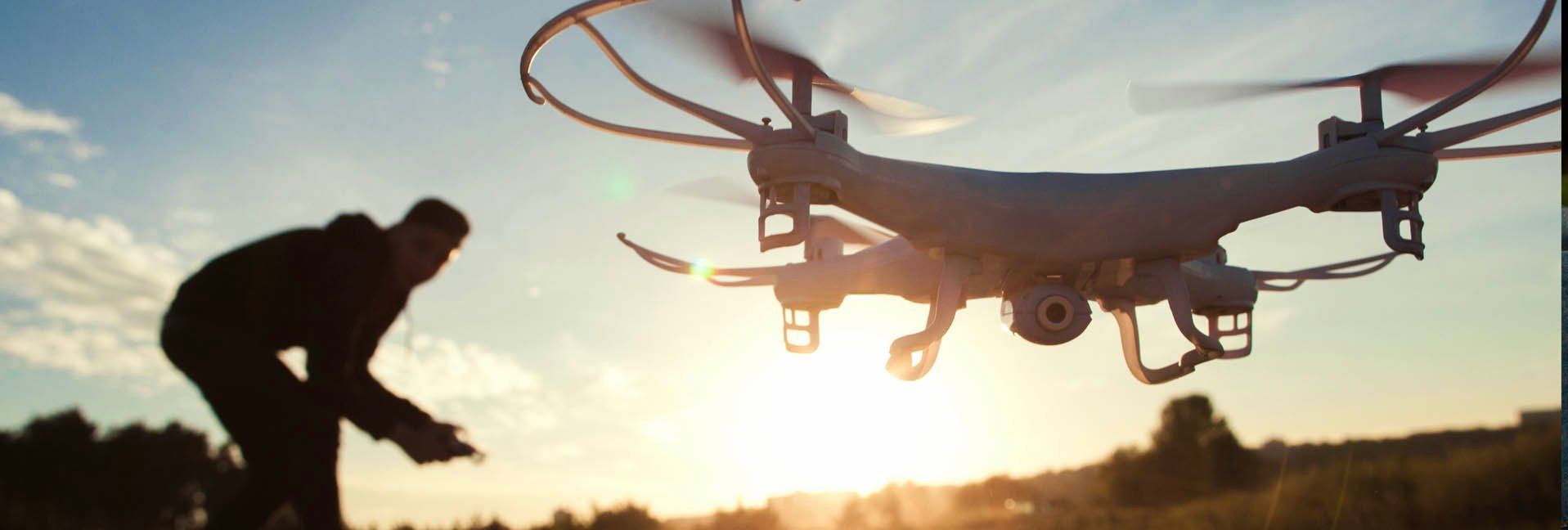
Often called UAVs (for Unmanned Aerial Vehicles), these lightweight often multi-rotor mini-helicopters are capturing views in a way that have never been seen before.
Maybe you can do that, too.And what else can a drone do around the farm?We take a look.
How can farmers use UAVs?
Just about anything that involves the farmers getting out on to their acres can be augmented by a drone, and they may someday replace the “eyes on” approach altogether.
Scouting for misplaced cattle?Check. Inspecting crops for insect damage, drought, or flooding?Check. Mapping a new farm or plot of ground?Check. Looking for weed control needed in pastures?Check.
“Drones have proven to be a cost effective way of carrying out the same surveys farmers have been doing of their land from a manned aircraft, but at a much lower cost and with higher frequency,” says Sally French, an industry blogger who calls her pages The Drone Girl(thedronegirl.com).
She says we can now use tools developed for satellite observation, making drones "a cheap and efficient way” of gathering this information. “From there, farmers can use data to make decisions about prescribing fertilizer, spotting diseases, and estimating yield.”
Few of us are rocket scientists, so fortunately there is software which simplifies interpretation of the data, such as from Drone Deploy. Drone Deploy says their tools can be used by anyone who knows how to use a smartphone, tablet, or laptop with no additional training needed.
Who’s flying now?
A recent analysis by Bard College (dronecenter.bard.edu) notes that there have been nearly 950,000 drone users registered by the FAA. The bulk self-identify as hobbyists, but that leaves more than 100,000 who use them for public good—such as for search-and-rescue or inspections—or for profit with aerial photography or some other activity.
While hip, trendy folks in California play and work with them—a quarter of drone users come from that state—Florida, Alabama, Illinois, Texas, and New York, Pennsylvania, North Carolina also have a healthy representation of users.
Clearly, they are capturing the imagination of city and country folk alike.“The great news is that drones continue to get cheaper and cheaper,” Sally notes.
“The majority of work can be done with something as simple as a DJI Phantom,which you can find for as low as $500 at stores like Best Buy,” Sally says.UAVs that used to easily exceed $5,000 can now be purchased for under $2000 or less, and these do far more and with better quality.
How to get started
You fly them using a two-handed controller, which can take some getting used to.Augment that with some GPS programming and things can get hairy real fast. Can you use a drone even if the words “Xbox” and “PS4” are foreign to you?
“Drones are incredibly easy to fly these days,” French tells us. “However, I’m recommending that before flying a $1000 drone in the air, you buy a cheap toy drone just to get the hang of the controls. You would much rather crash your $100 drone in a lake than your $1,000 drone.”
YouTube.com has many hobbyist videos to help; manufacturers and software companies usually offer webinars as well. After that, experts say, practice makes perfect.
What about licensing?
Before 2015, anybody could fly anything, anywhere, anytime. Those days are gone and we are all safer for it.
Let’s say you received a UAV for Christmas and are just now getting around to unboxing it.While the batteries are charging, visit the FAA website, registermyuas.faa.gov, and enter your registration information. (Except for certain extremely low-cost “toy” drones, any between .55 of a pound and 55 pounds must be registered.)You get to pay a five-dollar fee, too.
Then, move on to Step Two, obtaining a Part 107 license, the Remote Pilot Certificate.What are you in for?Alan Perlman, CEO of a drone pilot school called UAV Coach says it’s more straightforward than many realize, “but it’s no walk in the park” and requires deliberate study.
“Most of our students take 15 to 20 hours to go through lectures in concepts like Weather and Micrometeorology, FAA Drone Regulations, National Airspace System, and Loading and Performance.”
Getting licensed requires taking a 60-question multiple-choice test and scoring at least 70 percent. “So, really anyone over the age of 16 who sits down and studies can pass the test. That bar is set pretty low,” Alan says.“But on the other hand, it's nice that the certification process is so approachable.”
He also points out that you’ll want to log dozens of flight hours across a variety of simulators and drone systems to build proficiency. Mastering the nuances of the flight software and its various failsafes, settings, and intelligent flight modes, that can take a long time.
Around 70,000 have obtained their Remote Pilot Certificate so far.
Fun and profit
So, what can you do off the farm that might help you recoup a little of that licensing, cost, time and effort?The list is nearly endless.
Real estate—Do you know a real estate agent?They love to present homes, farms, and ranches in a way that is exciting and never seen before.
Publishing—Do you have a creative streak?You can use your drone to capture photographs that other people will pay for.Special events, sunrises and sunsets of familiar areas and landmarks all represent opportunity.It may be worthwhile to partner with a successful local photographer.
News—Drones not only record photos, but video as well.Your local television or cable station would love to have clear overview video to augment their on-the-ground reports. If you record something unique, polish up your negotiating skills.
Building and real estate inspections, bridge inspections, even livestock counts can be done via drone. So charge up your batteries and take to the air.
Learn more
Licensing help—uavcoach.com
Software—dronedeploy.com
Drone manufacturers:
The Future is (Almost) Here
About 20 years ago, I interviewed scientists, researchers, and daydreamers about what the future will bring to agriculture. GPS-based auto-steer on tractors was just being refined, and crop-yield mapping was still a head-scratcher for most. But one scientist had a breathtaking vision back in the 1990s that looked like this:
In the future, the farmer will launch a remotely piloted aircraft which will systematically map his field, up-and-back. Photo- and other sensors will note areas where pest infestations are evident. That information will be automatically beamed back to the office where a separate aircraft will be loaded with a small amount—say, a couple of gallons—of pesticide.
Because the aircraft knows exactly where the infestation is from GPS data, the craft will fly directly to the affected area and apply the chemical with near-surgical precision, turning nozzles on and off where needed—no waste, and no overspray, and reduced chemical cost.
Is that just some blue-sky dreaming? Not at all. Illinois drone builder HSE-UAV is producing models that do exactly this. True, these drones are pricey and require some specialized training but they are far less expensive than a crop-dusting aircraft and a trained pilot’s license.
Tags:Weekend Farmer

Acreage Life is part of the Catalyst Communications Network publication family.


